Often compared to the Galápagos, here's how to explore the best of Anacapa Island, Santa Cruz Island, Santa Rosa Island, San Miguel Island, and Santa Barbara Island.
When I was a rookie beach lifeguard in Carpinteria, CA, in the early 90s, I’d often gaze from afar at Anacapa and Santa Cruz Islands. From my tower, I strategized how I would kayak across the 25-mile-wide Santa Barbara Channel, then circumnavigate Channel Islands National Park. After 28 years of paddling there, I’m still plotting trips and routes from that same tower around those mysterious isles.
Steeped in natural history, five of Southern California’s eight Channel Islands make up one of the least-visited national parks in the country. Natural wonders abound on and around Anacapa, Santa Cruz, Santa Rosa, San Miguel, and Santa Barbara Islands. There are species of island flora and fauna found nowhere else on the planet except at this unique national park—which might be tough to fathom given the location is only 60 miles west of the megalopolis of Los Angeles. Due to its rich biodiversity, this chain has come to be known as “The Galápagos Islands of the North.”
How to Get to Channel Islands National Park
You can drive or take public transportation to the mainland visitor centers in Ventura and Santa Barbara, but Island Packers is the only boat concession to the national park.
The company's been in operation since 1968. Once on the islands, you've gotta traverse on foot or hit the water on a kayak or private boat.
A Guide to Kayaking Channel Islands National Park
The best way to immerse yourself within this island biome is paddling a kayak. Over the years, I’ve circumnavigated the four Northern Channel Islands many times, which is about 160 miles of paddling. I’ve kayaked from Santa Cruz to Santa Barbara Island in a day—about a 40- to 50-mile slog. Throughout the years, I’ve also mixed in nine channel crossings over the Santa Barbara Channel between the islands and the mainland. The four northern islands rest on a tectonic plate, and stagger westward, so crossings are between 11 to 32 miles each depending on where one launches and lands. I’ve also been guiding kayak trips at the national park for 21 years.
During this time, I’ve learned that kayaking around the chain offers access to incredible spots that can’t be reached on foot or even in most boats. Kayaking has given me many opportunities to access those concealed nooks and crannies of the islands that go un-named on a map. There have been countless intimate encounters with wildlife—and also some harrowing sea conditions, which is to be expected for a chain of islands exposed to weather from the northwest.
Kayak Outfitters
Channel Islands Adventure Company is the only kayaking concession at Scorpion Anchorage on Santa Cruz Island. Guides lead trips through the sea caves as well as to Potato Harbor, one of the prettiest spots on Santa Cruz—and the whole island chain.
Channel Islands Expeditions lead kayak trips from its fleet of boats to Anacapa Island and Painted Cave on Santa Cruz Island.
Should you want to camp overnight, book in advance at recreation.gov.
Ready to explore the best of Channel Islands National Park? Here's a guide to Southern California's five islands.
Chuck Graham
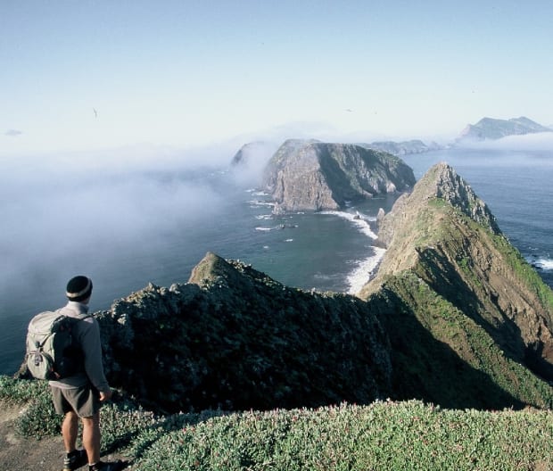
Anacapa Island
The narrowest and second smallest island in the chain is actually three small islets only noticeable at the lowest tides.
Kayaking Highlights Around Anacapa Island
West and Middle Anacapa aren’t open to the public, but East Anacapa Island is. All three are honeycombed with toothy sea caves, all of which are found on the north side. Over 100 grottos can be accessed depending on the tides and sea conditions. For visitors, it’s one of the top bucket list items while visiting the national park.
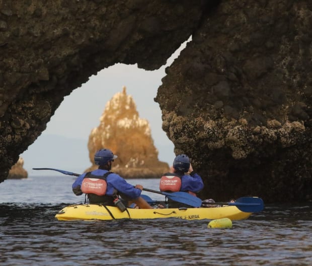
There are no beaches surrounding its 11 coastal miles. Sheer, Mordor-like volcanic cliffs are home to a wide array of hardy seabirds, California sea lions, and harbor seals hauling out at the base of those daunting crags. Don’t miss paddling underneath and around the iconic, 40-foot-tall arch that symbolizes the entire park. Paddling around the whole island in a day is very manageable. Hit it early and enjoy the sunrise over the Santa Monica Mountains to the east.
Where to Camp on Anacapa Island
To paddle and camp on this windswept marine terrace, you’ll need to hoist your kayak up onto the recently refurbished landing cove. Bring a long bowline to pull your kayak off the water. From there it’s 250 steps up onto the marine terrace that leads to the lighthouse, old Coast Guard buildings, and eventually the small campground.
Best Hikes on Anacapa Island
The two best hikes on East Anacapa are short. One is to Inspiration Point, about 1.5 miles from the landing cove. This is one of the best views throughout the national park. The walk to the lighthouse is even shorter, and it’s the only beacon on the northern chain.
Chuck Graham
Santa Cruz Island
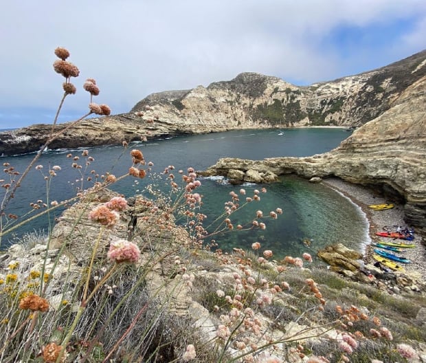
The largest island off the coast is also the most biodiverse, with 60 plants and animals seen nowhere else in the world. It possesses 77 coastal miles, is mountainous, and 22 miles long. The Nature Conservancy owns 76 percent of the island; the national park owns the other 24 percent at the southeast end.
Kayaking Highlights Around Santa Cruz Island
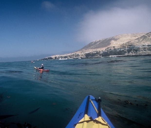
A fun kayaking trip is getting dropped off at Prisoners Harbor by Island Packers. It’s a six-mile downwind paddle from there to Scorpion Anchorage, the main hub of the national park. Along the way are plenty of deserted beaches and coves. From Coche Point to Scorpion Anchorage are some of the most impressive sea caves throughout the chain.
Sea caves on the north side of the island are bountiful, including Painted Cave, one of the largest in the world. The 160-tall grotto extends almost a quarter-mile into the island with four dark, dank chambers to paddle into.
Chuck Graham
Wildlife to Spot at Santa Cruz Island
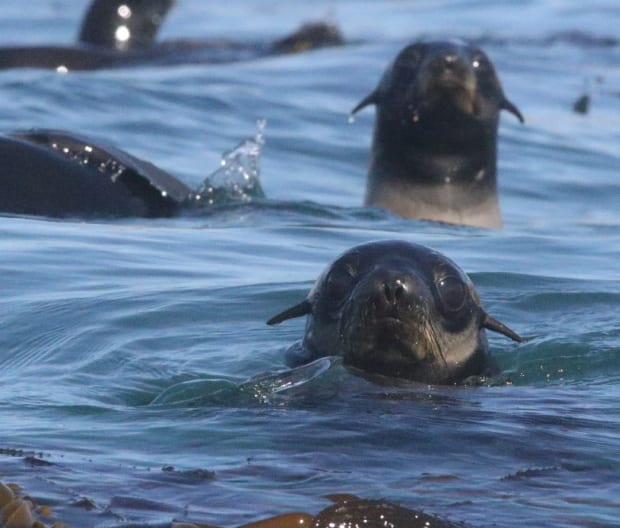
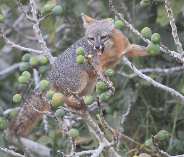
Sea lions and harbor seals enjoy the coastal topography. Seventeen nesting pairs of peregrine falcons can be seen at any time perched on the cliffs. Santa Cruz Island is the only place in the world to see the island scrub-jay, known for having the smallest range of any bird in North America. The isle's largest predator is the endemic island fox, the continent's smallest fox species. After a successful reintroduction program on Santa Cruz, bald eagles have now fanned out, reclaiming old territories across the entire chain.
Chuck Graham
How to Camp on Santa Cruz Island
Camping on the island is at Scorpion Anchorage and at Del Norte. Water is available at Scorpion Anchorage, but it will need to be packed into Del Norte. For trash, it’s pack in, pack out on this island and all the others. A permit is always required for camping.
Essential Gear for Kayaking Santa Cruz Island
To paddle inside the sea caves or anywhere around the chain, bring a helmet, leash to connect your paddle to your kayak, light, and of course a personal floatation device (PFD).
Chuck Graham
Santa Rosa Island
The island itself is incredibly unique. The oldest human remains in North America were discovered on the island in 1959—known as “Arlington Man” and estimated to be 13,200 years old. Whoever he was, Arlington Man built some sort of watercraft on the mainland and paddled the channel to the island. Fossil remains of Columbian and pygmy mammoths have also been discovered on the island; they're some of the most intact remains in the world.
Like Santa Cruz, there are several canyons with year-round water. Paying attention to the weather is crucial out here. The farther west you paddle around these islands, the more susceptible you are to northwest winds. Santa Rosa has 32 coastal miles, with many coves to duck into when the wind picks up.
Chuck Graham
Kayaking Highlights Around Santa Rosa Island
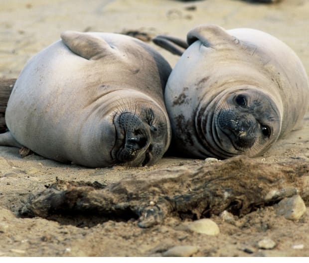
Kayaking around Santa Rosa is an epic adventure. I’ve had some glorious experiences here, from sharing my tent with three northern elephant seal pups to an encounter with the island spotted skunk. It’s another endemic species found only on Santa Cruz and Santa Rosa Islands, and one of the rarest carnivores in the world. I’ve also paddled the island when northwest winds were so fierce I was nearly knocked out of my kayak.
How to Camp on Santa Rosa Island
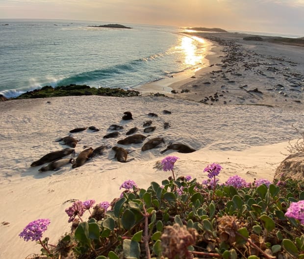
From August through December, beach camping is permitted around this scenic, rugged island. A single designated campground on the island is located at Bechers Bay pier. There are 15 sites, and the campground is near the beach at Water Canyon. Also nearby is a gorgeous hike to Torrey Pine Forest—the world's only other forest like this beyond San Diego's far more visited Torrey Pines State Natural Reserve.
Chuck Graham
San Miguel Island
After paddling around this island a half-dozen times, it's become my favorite. San Miguel is a challenge to get to, whether by boat or kayak. It’s remote, rugged, and breathtaking, and the wildlife is incredibly rich. Situated farthest to the northwest and taking on wind and swell from all directions, the island is very exposed to weather. Circumnavigating it requires constant attention to weather and swell forecasts.
Kayaking Highlights Around San Miguel Island
A reliable way to gauge sea conditions at San Miguel is by paddling west to Harris Point from Cuyler Harbor. It's where all kayaking trips begin and end on the island, and also where all camping trips begin and end via Island Packers. From Cuyler Harbor it’s about a 30-minute paddle. From there you can look around the corner all the way to Castle Rock. If sea conditions are calm, then it’s a go, but if it looks nasty, all you do is simply turn around and head back to Cuyler.
Chuck Graham
There are 27 coastal miles around this idyllic isle. From Harris Point, paddle toward Castle Rock, the lonely-looking rocky spire west of Simonton Cove. You’re not alone from here. There’s plenty of seals and sea lions to keep you company. From there, the real challenge begins with navigating a route through the reef passes of Point Bennett. This is arguably the most volatile region in the national park. Weather and swell are wild here. It’s also home to the largest congregation of seals and sea lions in the world—roughly 30,000 animals! Six species of pinnipeds include northern elephant seals, California sea lions, harbor seals, stellar sea lions, Guadalupe fur seals, and northern fur seals.
Where to Camp and Hike on San Miguel Island
Nine rustic campsites on the island are thankfully shielded from the wind. San Miguel Island used to be a bombing range during World War II, and supposedly there’s still live ordinance on the isle, which means all hiking is ranger-led. It’s well worth it. The island doesn’t get a lot of visitors, and the scenery is stunning. Hikes lead to several breathtaking overlooks, including Point Bennett and the petrified forest known as Caliche Forest.
Chuck Graham
Santa Barbara Island
About 15 years ago, I was writing a story about this lonely isle. It was a four-day trip that turned into 10 days. Fierce northwest winds kicked up, and Island Packers couldn’t make it there. I enjoyed every minute of it. Each morning before the wind arrived, I’d paddle around the island, about a 90-minute sprint to start another windy day.
Kayaking Highlights Around Santa Barbara Island
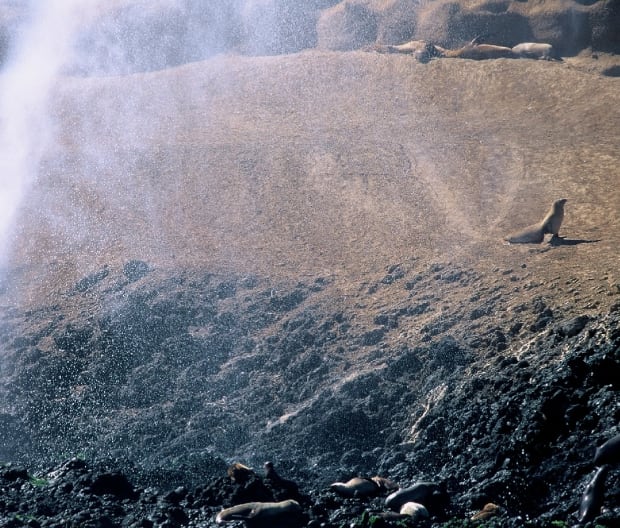
The smallest island in the national park is only six square miles, but don’t let that fool you. It’s a terrific island to kayak around. It’s loaded with sea lions and elephant seals, and one of the most impressive blowholes in the park. There are several challenging sea caves to paddle through, and the birdlife is prolific. To enjoy the island, you’ll need just a few days—and some patience.
In 2017, a winter storm washed away the landing cove, and priorities being what they are, rebuilding it for visitation has been on the back-burner. However, the landing cove at Anacapa is finished, and so is the new pier at Santa Cruz. Next in line is the landing cove at Santa Barbara Island.
from Men's Journal https://ift.tt/rgRepQ1


0 comments